What We Do

Our Services

End-to-end drone data capture and processing — from raw flight to investment-grade geospatial deliverables ready for immediate engineering and planning use.

01

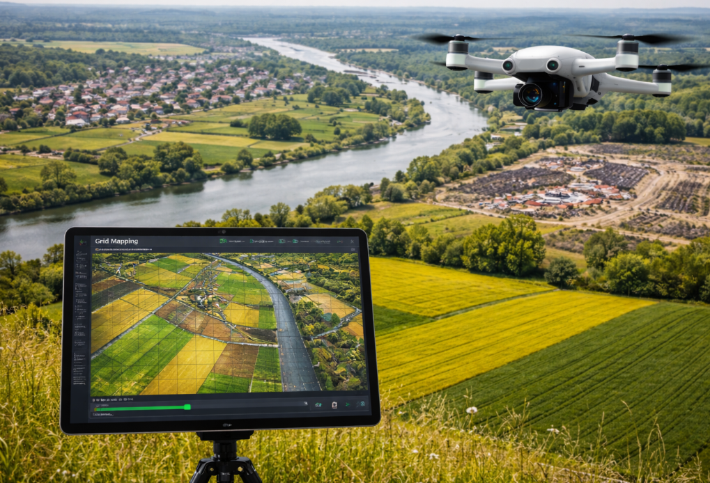
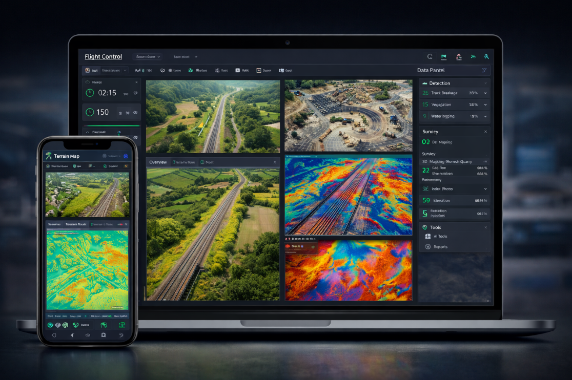
RGB Aerial Survey & Mapping

High-resolution aerial photography processed into accurate orthomosaic maps, digital surface models (DSM), and digital terrain models (DTM). Our RGB surveys deliver 2.5cm ground sample distance for demanding engineering, planning, and monitoring applications.

Used extensively by architects, civil engineers, urban planners, and government bodies for site analysis, progress monitoring, land records, and large-area topographic mapping.

Orthomosaic GeoTIFFDigital Surface ModelDigital Terrain ModelContours (0.25m–1m)Block LevelsPoint Cloud3D Mesh ModelSurvey Report PDF
GSD
2.5 cm
XY Accuracy
±5–10 cm
Z Accuracy
±10–15 cm
Coverage
2000+ acre/day
Camera
20MP survey-grade
Overlap
75% frontal, 75% side
Formats
GeoTIFF, LAS, SHP, DXF, KML
GPS
RTK enabled
RGB Aerial Survey drone survey service
02

Aerial LiDAR Mapping

Airborne LiDAR generates dense 3D point clouds with the ability to penetrate through vegetation canopy to capture true ground elevation — something RGB cameras cannot achieve. Ideal for forested corridors, railway alignments, and complex terrain.

We process LiDAR data into classified point clouds, bare-earth models, vegetation height models, and structural analysis datasets for infrastructure planning and construction.

Classified Point Cloud .LASBare Earth DTMCanopy Height ModelIntensity MapCross-Section ProfilesCorridor AnalysisBuilding FootprintsDEM Derivatives
Sensor
High-performance LiDAR
Point Density
240+ pts/m²
XY Accuracy
±5–10 cm
Z Accuracy
±10–15 cm
Returns
Multiple return
Range
120m AGL
Classification
Ground, Veg, Building, Water
Formats
LAS 1.4, LAZ, ASCII XYZ, DXF
Aerial LiDAR drone survey service
03

Thermal Drone Survey

Radiometric thermal imaging captures surface temperature variation invisible to conventional cameras. Our thermal surveys use a dual-sensor platform that captures simultaneous radiometric thermal and RGB imagery.

Applications include solar farm PV panel inspection, agricultural moisture mapping, hydrological seepage identification, and industrial infrastructure monitoring.

Radiometric TIFFThermal OrthomosaicAnomaly ReportTemperature MapsPanel-Level AnalysisCSV Data Export
Sensor
Radiometric + RGB dual
Sensitivity
<50 mK @ F1.0
Temp Range
-20°C to 150°C
RGB Camera
20MP simultaneous
Thermal Imaging drone survey service
04

Land Survey & Volumetrics

Comprehensive land survey services including block level capture, cut-and-fill volume calculations, stockpile measurement, boundary delineation, and contour profiling.

We serve quarry operators, civil contractors, BBMP/BDA, and infrastructure developers across India with repeat survey capability for monitoring earthworks over time.

Block Level ReportCut & Fill AnalysisVolume EstimationContour MapsCross SectionsArea DelineationDXF / AutoCADBefore/After Comparison
GSD
2.5 cm
Volume Accuracy
±2–5%
Contour Interval
0.25m–1m+
GPS
RTK / PPK
Turnaround
48–72 hrs
Formats
DXF, DWG, CSV, PDF
Land Survey & Volumes drone survey service
05

3D Documentation

Axesmap runs an internal Digital Heritage programme dedicated to the non-invasive 3D documentation of archaeological sites, historical monuments, and cultural structures across India.

Output models with 4K texture maps are delivered in OBJ, FBX, and GLB formats — compatible with web viewers, VR/AR platforms, 3D printing, and BIM tools.

3D Mesh ModelTextured OBJ / FBX / GLBPoint CloudOrthographic ViewsBIM-Ready ModelAR / VR Ready4K Texture Maps
Method
Structure-from-Motion
Texture Maps
4K resolution
Formats
OBJ, FBX, GLB
Change Detection
Multi-epoch comparison
3D Documentation drone survey service
06

AI Analytics & Web Dashboards

Beyond data capture, Axesmap builds intelligent solutions for recurring project management. Custom web dashboards give clients real-time visibility into survey data, automated reporting triggers, and AI-powered data analysis pipelines.

We integrate automated client notifications, change detection alerts, and AI models for classification — building solutions tailored to your operational workflow.

Web DashboardAutomated ReportsAI ClassificationChange DetectionClient PortalSMS / Email AlertsAPI Integration
Dashboard
React / Mapbox web app
AI Pipeline
Analysis, Reporting
Notifications
SMS, Email, WhatsApp
Integration
GIS, ERP systems
AI Analytics & Web Dashboards drone survey

Tell Us Your Project Scope

Our team will respond within 24 hours with a detailed survey plan, methodology, and indicative quotation.

Request a Proposal Call Us